OSM Basics
This section explains the basic principles of OSM.
History
OpenStreetMap was founded in 2004 by Steve Coast. Read more in the History of OpenStreetMap.
Exploring the OpenStreetMap Website
The OSM Data Model
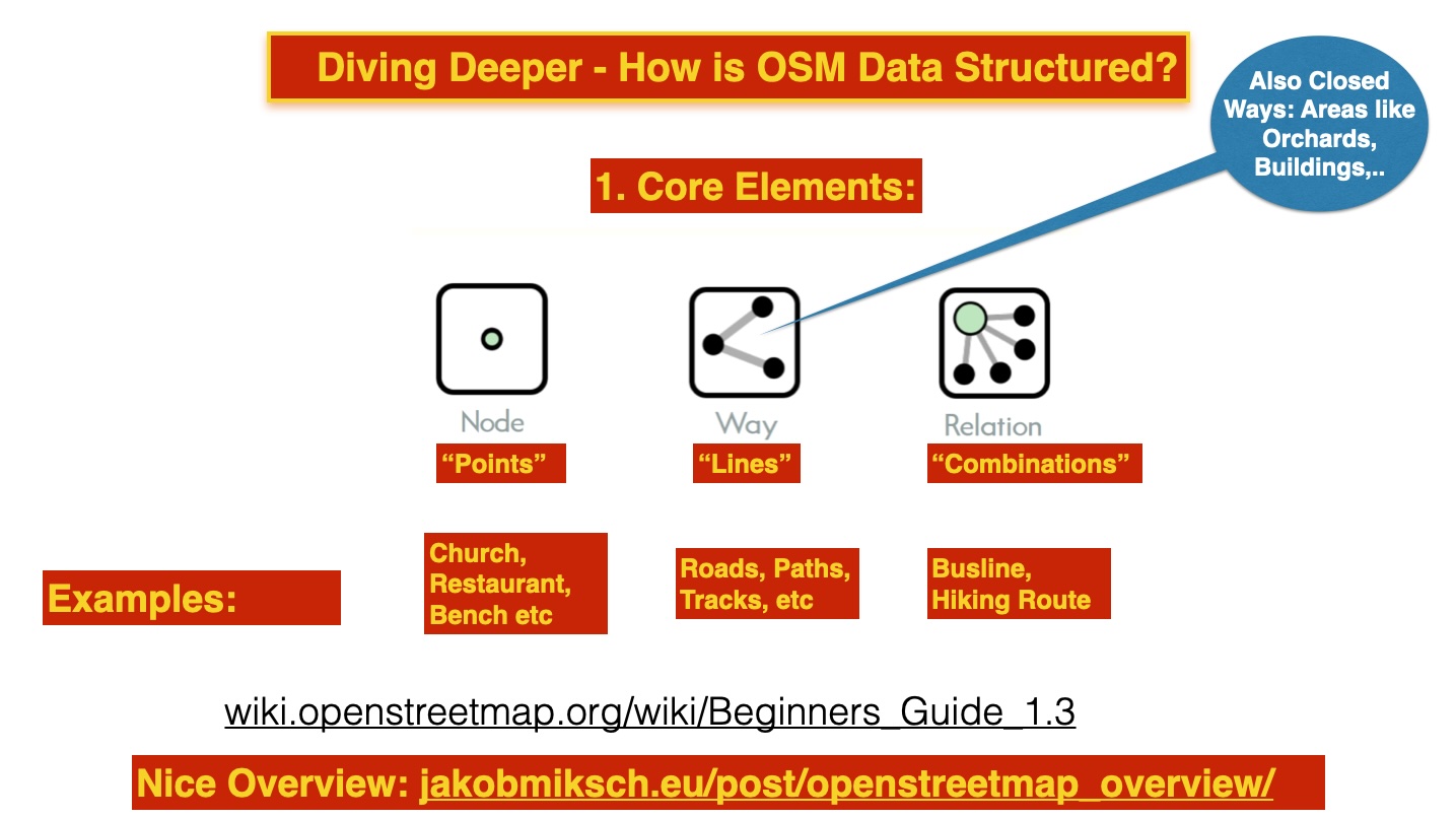
In the OSM data model, geometries are central.
Think of points, lines, areas, and combinations thereof.
These geometries are called Elements in OSM.
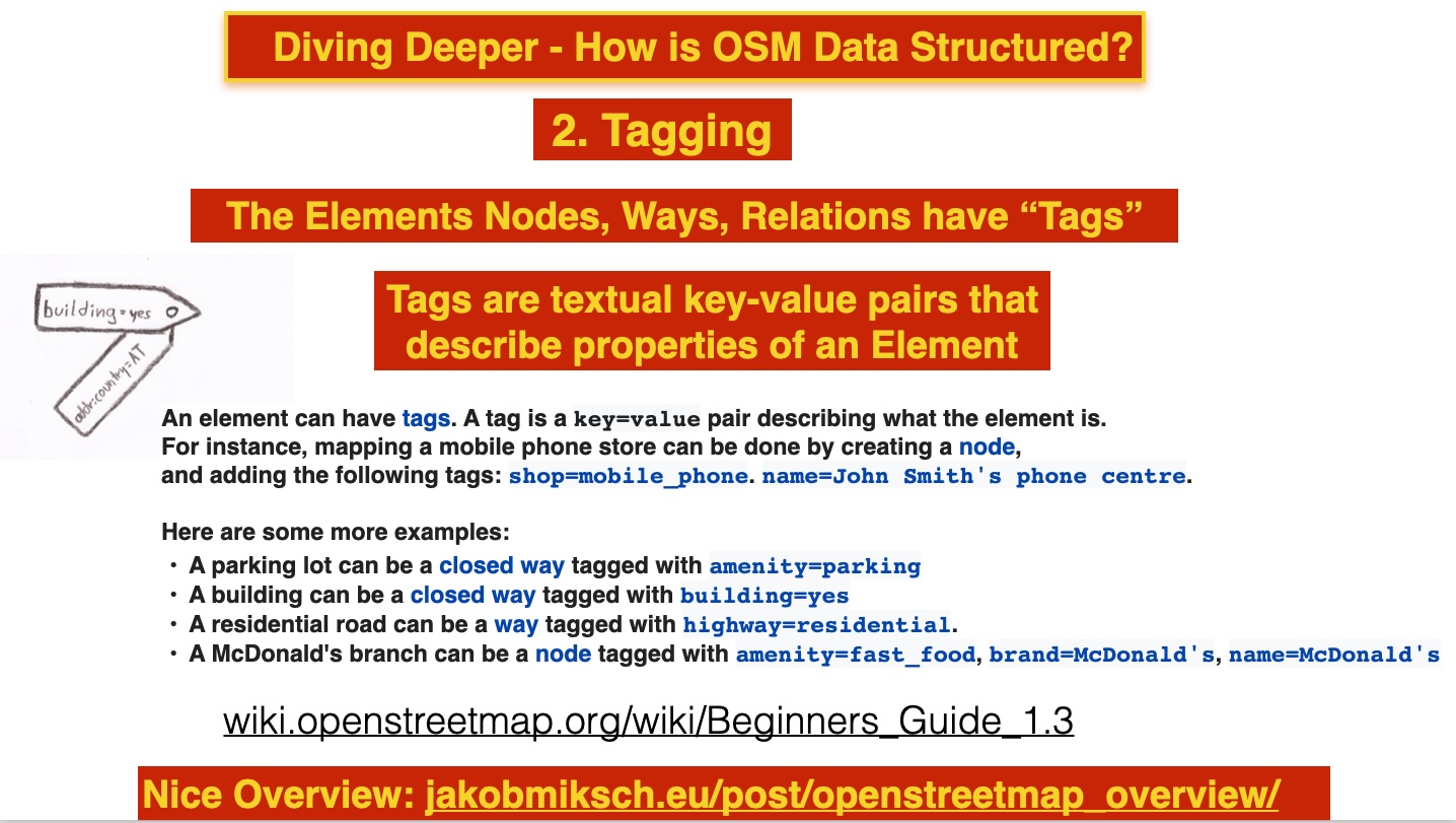
Each Element is assigned properties, sometimes referred to as metadata, in the form of Tags.
The Elements in OSM terminology are:
- Node (think: points)
- Way (think: lines)
- Closed Way and Area (think: open and filled areas, polygons)
- Relation, combinations of Elements, e.g., hiking routes. We will not cover this here.
- Each Element has a unique 64-bit integer Id.
Instead of models and schemas with attributes, like in GML, OSM uses Tagging:
- Each Element (see above) is described with one or more Tags.
- A Tag is a
key=valuepair. - For example, for a Way:
highway=residentialor for a parking lot (Closed Way):amenity=parking. - Within OSM, there is "ongoing" consensus via the Wiki on the set of Tags to use.
- Some OSM editors, like iD, use presets for Tags to assist users.
- See the detailed explanation.
- OSM implicitly recognizes Map Features through tagging.
- Consult Directrices de etiquetado for Spain-specific mapping rules
Tip
The TagInfo website/app at taginfo.openstreetmap.org provides detailed information about the use of tags.
The tags used specifically in Spain can be found at taginfo.geofabrik.de/europe/spain.
But best is to search on the OSM Wiki.
Every tag, whether it's a key or a key=value, can be found on the OSM Wiki.
For example, typing in 'market' will lead you to: amenity=marketplace.
Creating an Account
We ask participants to do this in advance (via email) to save time.
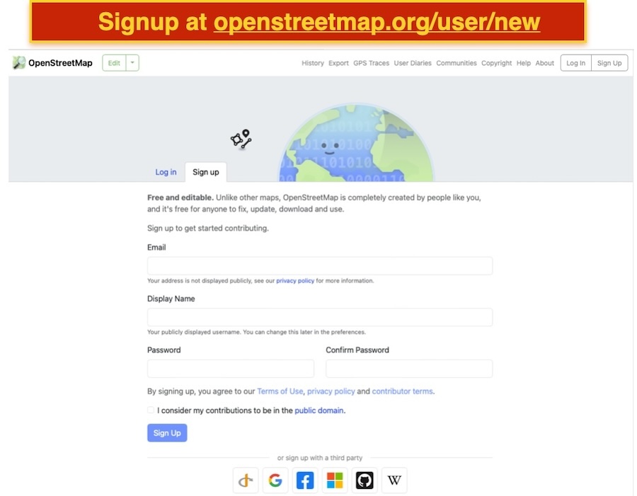
Registration is easy via www.openstreetmap.org/user/new.
You don’t necessarily have to use your real name as your username, also known as an "OSM handle." This can be changed later.
Additionally, your home location doesn’t need to be your actual address. That, too, can be adjusted later.
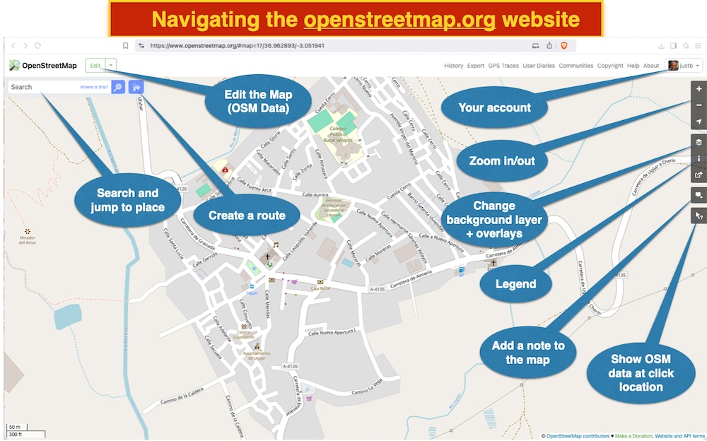
Navigating openstreetmap.org
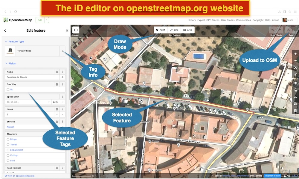
This is the main website. When you have logged in, you will be on the default map with some icons and menus as explained in the image below. We encourage you to explore yourself!
Edit with iD Editor (browser)
This, "iD", is the default editor available on openstreetmap.org.
When you log in, you’ll see an 'Edit' button in the top left corner. Clicking this will open the iD Editor.
The background map will then change, usually to the most detailed aerial imagery.
In Spain, this is the PNOA aerial imagery from IGN with high resolution. ign.es also has a topographic map but this is outdated!
We will only cover the basics of the iD Editor.
Tip
You can add a custom background map in iD, for example from Catastre. Go to Layers and then "Custom..."
In a form, you can insert a symbolic URL, for example, a layer from Cadastral maps.
Here’s an example for the "Spanish Cadastral Parcel Web Map Service of the Directorate General of Cadastre according INSPIRE profile" Buildings Layer
layer, which you can copy-paste:
https://ovc.catastro.meh.es/cartografia/INSPIRE/spadgcwms.aspx?REQUEST=GetMap&SERVICE=WMS&VERSION=1.3.0&FORMAT=image/png&TRANSPARENT=true&LAYERS=BU.Building&CRS={proj}&STYLES=&WIDTH={width}&HEIGHT={height}&BBOX={bbox}
But beware: Spain buildings and addresses import should be done via
the Buildings and Addresses import guidelines!
Community
- OSM Forum
- Spanish Community on OSM Forum
- Spain Landing Page on OSM Wiki
- OpenStreetMap Spain Telegram Group
- Asociación OpenStreetMap España
- ideandalucia.es - many nice maps of Andalucía!
The main communication channel for the Spanish Community is its open Telegram Group.
Tip
With your OSM account, you automatically have access to the OSM Forum.
Explore Mapping Results
There are several ways to find out what you and others have added to OSM. Here are two sites you can explore:
- simon04.dev.openstreetmap.org/whodidit - click on rectangles
- overpass-api.de/achavi (enter a date back in time)
We will look at these after we get back.
More Information
- OSM Wiki
- Start with OSM on LearnOSM (the English version is slightly more up-to-date)
Continue to CoMaps!
